Reference
Etna Webcam and Volcano Alerts: What to Check Before You Go Up
The best live view of Etna comes from the volcano’s own monitoring network. The Osservatorio Etneo, the Catania section of INGV (Italy’s national institute of geophysics and volcanology), publishes images from its surveillance cameras on a public page, some working in visible light and some in the thermal infrared. The cable car operator adds its own live webcams above 2,500 m, including one at its upper station pointing at the summit craters.
A webcam tells you what the mountain looks like. It does not tell you whether you can go up. For that you need the alerts behind the pictures: INGV’s communiqués and its notices for aviation, the Civil Protection alert level, the regional operating phase and the mayors’ ordinances that follow from it and, if you are flying, the status of Catania airport. This guide explains where to find each one, how to read it, and what to check the evening before and the morning of your trip.
Where to watch Etna live
INGV’s surveillance cameras
INGV’s volcano surveillance page for Etna shows the latest frame from each of its camera stations, side by side. These are the same cameras the volcanologists use. The Civil Protection Department describes them as working in the visible and thermal bands, sited on the eastern and southern flanks of the volcano.
Each image is labelled with a short code rather than a place name. INGV’s own articles use these codes when they publish frames: EMCT, for example, is a thermal camera on Monte Cagliato and EMCH is a visible-light camera at the same site. You do not need to learn them all; what matters is knowing which kind of camera you are looking at.
- Visible cameras show what your eyes would see: cloud, snow, a plume, the colour of the sky. At night they show little unless there is glowing lava.
- Thermal cameras record heat rather than light. Hot lava, an active vent or a fresh flow stands out as a bright patch even when the visible image is dark or hazy.
Two practical details trip people up:
- The times are in UTC. INGV’s page says to add 1 hour when standard (winter) time is in force and 2 hours in summer to get Sicilian local time. In summer, a frame stamped six o’clock UTC was taken at eight in the morning in Sicily.
- The page does not refresh itself. Automatic refresh is switched off, so reload the page to see the newest frames.
INGV’s live video channel
For moving pictures, INGV also runs a live streaming channel for the volcano, called Etna’s TV channel (EtnaTVChn). It is the closest thing to a live Etna cam from the observatory itself.
The cable car operator’s webcams
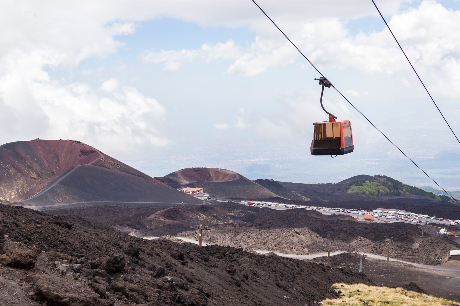
The company that runs the cable car on the south side publishes its own live webcams, positioned above 2,500 m. One looks from the upper cable car station at 2,500 m towards the summit craters; a second looks from the Montagnola towards the craters (it was down for maintenance when this article was checked), and a third shows the ski lifts at Piano Provenzana on the north side. Each has a timelapse feature for reviewing the previous day, which is useful for seeing whether yesterday’s cloud cleared in the afternoon.
These are the cameras to check if you are wondering whether the upper stages will be worth it. If the view from the upper station is a white wall, the cable car ride will be too. Our guide to the cable car, the 4x4 and the summit rules explains what each stage above Rifugio Sapienza includes.
What a webcam can and cannot tell you
A webcam is good at three things: whether the upper mountain is in cloud, whether there is a visible plume, and whether there is glowing activity at night. It is poor at everything else. A plume on a camera does not tell you on its own whether it is mostly gas or ash, how high it is, or which way the wind will take it. A clear image does not mean the summit zone is open, and an eruption on the screen does not always mean the tourist areas are shut. For those questions, read the alerts below.
INGV’s bulletins and communiqués
INGV publishes two kinds of written update, both in Italian.
The weekly bulletin. Every week INGV issues a multiparametric monitoring bulletin for Etna, a PDF that brings together the different strands of monitoring data; the latest in its list when this article was checked was dated 29 September 2026. It is the best summary of the past week, but it is a look back, not a forecast for tomorrow.
The communiqués. When something happens, INGV sends out short communiqués on volcanic activity, listed on its site with the sending time in UTC. The list shows their type: a first notification when an event begins, generic updates while it goes on, and an end-of-phenomenon notice when it stops. If the most recent entry for Etna is a first notification or an update, with no end notice after it, an event is probably still under way.
A few Italian words cover most of what you will read:
- attività stromboliana: Strombolian activity, explosions throwing out glowing fragments.
- fontana di lava: lava fountain.
- emissione di cenere: ash emission.
- colata lavica: lava flow.
- fine fenomeno: end of the phenomenon.
The VONA and the aviation colour code
The update most visitors hear about is the VONA, the Volcano Observatory Notice for Aviation. INGV’s page describes VONAs as short, plain-English messages for dispatchers, pilots and air-traffic controllers about volcanic unrest and eruptions that could put ash in the sky. A VONA is issued whenever the volcano’s aviation colour code changes.
The four colours are a standard aviation scheme. The US Geological Survey, which uses the same colours, defines them like this:
| Colour | What it means |
|---|---|
| Green | The volcano is in its typical background, non-eruptive state. |
| Yellow | Signs of unrest above the known background level. |
| Orange | Heightened unrest with a greater chance of eruption, or an eruption under way with no or minor ash. |
| Red | An eruption with significant ash emission into the atmosphere is imminent, under way or suspected. |
On Etna the code can move fast. Through September 2026 INGV’s list of notices switched between orange and red again and again. On 29 September 2026, for example, it shows a red notice at 05:25 UTC and an orange one at 07:51 UTC the same morning.
Keep in mind what the code is for. It describes the hazard to aircraft from ash in the air. It is not the same as the Civil Protection alert level, which describes the state of the volcano and the risk on the ground, and it says nothing directly about whether the cable car is running.
What the colour means for flights into Catania
For Catania airport, the aviation code and the wind together decide what happens. The Civil Protection Department lists heavy disruption at Catania Fontanarossa among the main effects of ash fall.
The end of September 2026 shows how quickly things change. After almost three days without flights, the airport returned to full operation on the evening of 28 September when INGV lowered its notice from red to orange, ANSA reported. The next morning renewed ash from the North-East Crater produced an eruption cloud 4 km high, the notice went back to red, and with the wind blowing south towards the airport, flights were suspended again. That stop lasted just over half an hour: arrivals and departures resumed as soon as the alert went from red to orange.
Two lessons follow. A red notice does not always mean a long closure, and an orange one does not guarantee your flight. And the airport’s own advice is the one to follow: SAC, which runs the airport, asks passengers to check their flight status with their airline before setting off for the airport.
The Civil Protection alert level
The national alert level describes the volcano’s overall state. Since 1 February 2016 it has been shown in four colours (green, yellow, orange and red) and declared by the Civil Protection Department together with the Sicilian Region, based on the assessments of INGV and the other monitoring centres. As a rule the Department holds a video conference with them every month to review Etna’s state of activity.
When this article was checked at the end of September 2026, the Department’s Etna page gave the alert level as yellow. The same page carries an important warning: some of Etna’s phenomena are sudden and completely unpredictable, so even at green the risk is never absent. The level can also jump more than one step at a time.
Summit access: operating phases and ordinances
Whether you can walk high on the mountain is decided locally, by ordinance.
The fixed rules
Some rules apply whatever the alert level. Since August 2010, ordinances of the Prefecture of Catania have closed the summit zone to independent visitors from 2,920 m at Torre del Filosofo on the south side and from 2,990 m at Punta Lucia on the north side, and visits to the summit craters must be accompanied by qualified alpine or volcanological guides.
Sicily’s regional civil protection adds its own map. It defines the summit zone as everything above 2,500 m, up to the summit craters. Within it, a “yellow zone” around the craters includes the area near Torre del Filosofo, at 2,920 m, and the area near the Pizzi Deneri volcano observatory, at 2,850 m. In that zone the volcanic risk is never zero, even when the volcano is quiet.
How the phases change access
The region runs four local operating phases: base, attention, pre-alarm and alarm.
- Base: visiting the summit zone with legally qualified guides is recommended.
- Attention: mayors regulate access to the summit zone by ordinance.
- Pre-alarm and alarm: mayors close the summit zone by ordinance.
What the ordinances actually say
The ordinances are specific. The volcano guides’ site summarises those issued by the municipalities of the summit area in September 2025; Nicolosi’s, on the south side, is dated 11 September 2025. Among the rules they list:
- at most 10 people per guide and 400 people a day in the guided zone;
- a band of at least 500 metres around the South-East Crater closed;
- groups setting off at 15-minute intervals, with a protective helmet for every participant;
- unguided walks in the summit zone only from dawn to sunset, with no bivouacs;
- the north-side 4x4 track from Piano Provenzana to Piano delle Concazze, at 2,800 m, suspended immediately when the alert phase moves from F0 to F1 or F2.
During eruptions, extra ordinances appear. On 25 August 2025, with lava flowing on the south flank of the South-East Crater, the mayor of Belpasso ordered everyone to keep at least 50 metres from the lava and, given the alert level, kept the yellow zone closed.
Ordinances are replaced as the situation changes, so treat any list, including this one, as a snapshot. The guide or operator you book with will know which ordinance is in force that day.
Putting the alerts together
No single signal answers the question “can I go up tomorrow?”, but read together they usually point the same way.
A quiet day. The communiqués list ends with an end-of-phenomenon notice, the aviation code is green or yellow, and the cameras show at most a gas plume. On days like this the volcano is rarely what stops you; wind and cloud at altitude are the things to watch, and the operator’s webcams are the best guide.
An eruptive episode under way. A first notification has gone out with no end notice yet, the aviation code is orange or red, and the thermal cameras show a hot vent or a flow. Expect the summit zone to be restricted, expect guided programmes to change, and if you are flying that day, check your flight before anything else.
The days after. The end notice has been sent and the code has come down, but ordinances are revoked and replaced on their own timetable. Ask your guide or operator what is allowed before assuming everything is back to normal.
The evening before: a checklist
- Look at INGV’s cameras, remembering the times are in UTC. Is there a plume, glow on the thermal images, or cloud down to the refuge?
- Read INGV’s communiqués list. Is there an event in progress, with no end-of-phenomenon notice yet?
- Check the latest aviation colour code if you are flying in or out in the next day or two.
- Check the Civil Protection alert level and whether it has changed recently.
- Ask your guide or tour operator whether the programme is going ahead as planned, and read their cancellation terms if you have not already.
- Check the weather at altitude, not the forecast for the coast. Wind and cloud can close the upper stages even when the volcano is quiet.
The morning of your trip
- Check the operator’s webcam from the upper station. If the summit area is clear first thing, it is usually worth going early, before afternoon cloud builds.
- Look at the newest aviation notice if you fly that day, and check your flight with the airline before leaving for the airport.
- Pack for the top, whatever the webcam shows. The Civil Protection Department advises a windproof jacket and a cap against the sun, plus water and food; our guide to getting to Etna covers the drive and the bus.
- Leave slack in the day. If the upper stages open late or close early, you want time to adapt.
If the upper mountain is closed
A closure at the top rarely means a wasted day. The Silvestri craters beside Rifugio Sapienza are free and a short walk from the car park, and a 20-minute walk takes you to the rim of the upper crater. The lower slopes, lava caves and old craters lie below the summit zone, so tours that stay down there, such as the sunset jeep tour from Catania with its lava cave and old vents, do not depend on the summit being open.
If you have booked the cable car, 4x4 and walk to 3,000 m, ask the operator how the programme changes when the upper stages close and what the refund or rebooking terms are. The tours page lists what is available on your dates, and the FAQ covers the basics of visiting.
Frequently asked questions
Is there a live webcam of Mount Etna?
Yes. INGV publishes images from its visible and thermal surveillance cameras on its Etna video-surveillance page, and runs a live streaming channel. The cable car operator also has live webcams above 2,500 m, including one from the upper station towards the summit craters.
Why do the times on INGV’s webcam page look wrong?
They are in UTC. Add 1 hour in winter and 2 hours in summer to get local time in Sicily. The page does not refresh on its own, so reload it for the latest images.
What does a red VONA for Etna mean?
It means an eruption with significant ash emission is imminent, under way or suspected. It is a warning for aviation about ash in the air, not a measure of the danger to people on the ground.
Does a red alert close Catania airport?
Not automatically. Flights are suspended when ash and wind make it unsafe, and they resume when conditions allow; at the end of September 2026 one stop lasted just over half an hour, another almost three days. Check your flight with the airline before going to the airport.
How do I know if the summit of Etna is open?
The summit zone is always guided-only above the closure lines, and during activity the mayors’ ordinances can restrict or close it. Your guide or operator will know which ordinance is in force; ask them the day before.
Can I see lava on the Etna webcam?
Sometimes. When lava is flowing, it shows most clearly on INGV’s thermal cameras and, at night, as a glow on the visible ones. Much of the time there is nothing to see except cloud or a gas plume.